


Title deed, zoning status, Floor Area Ratio (Emsal), ground and location — on one screen, in seconds.
Sakarya · İstanbul · Kocaeli · Ankara · İzmir · Antalya
partially Bursa · all of Türkiye soon…
How it works
- 1
Enter the parcel
Type the province, district, neighbourhood and block/parcel number, or tap on the map. You can also find it from your location.
- 2
See the plans and the rules
Plan levels, building rules such as Floor Area Ratio (Emsal) and Building Coverage Ratio (TAKS), ground and surroundings — on one screen.
- 3
Take a report or present it
Download the PDF report, or explain the parcel to your client directly in presentation mode.
Everything you need to know about a plot of land
No more trips to the municipality for information. View upcoming development plans on your screen with one click.
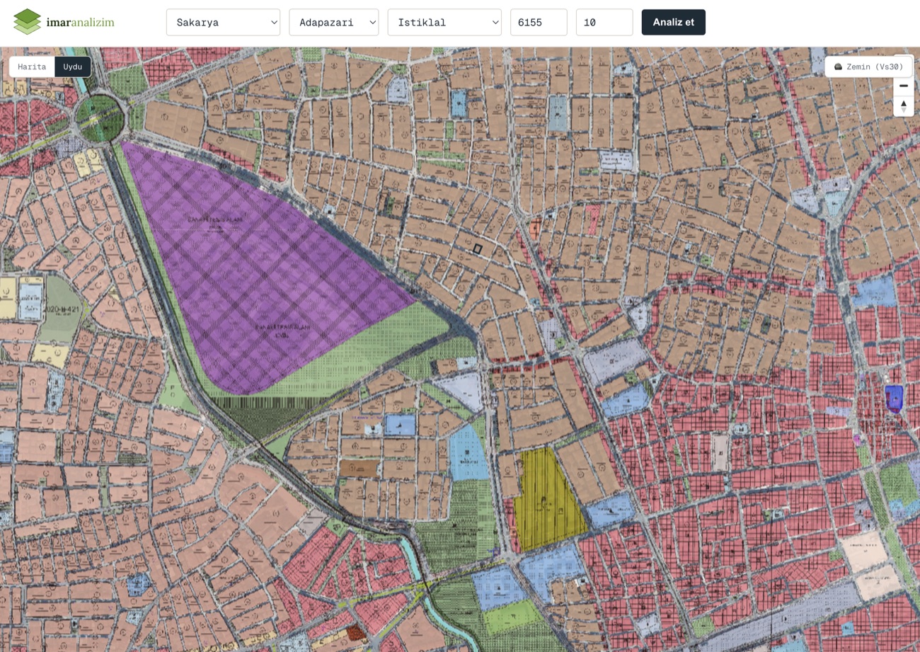
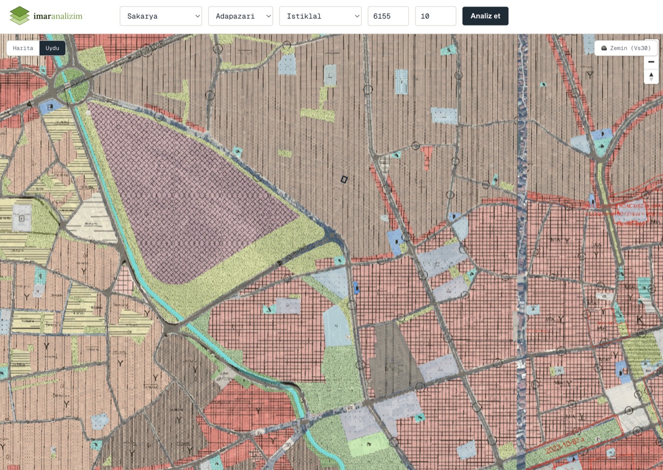
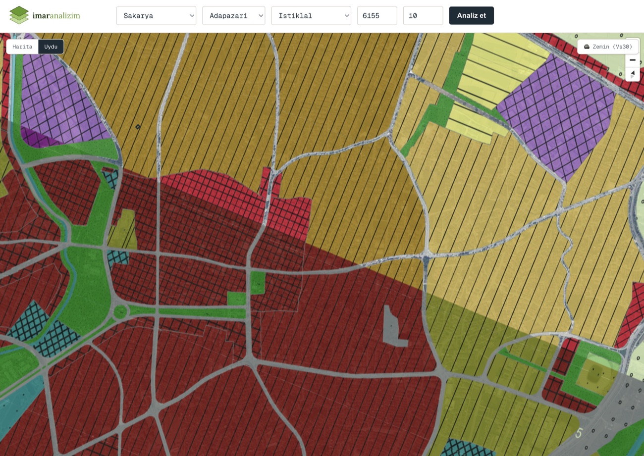
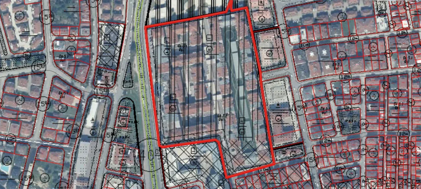
All plan levels together
Implementation Development Plan (Uygulama İmar Planı), Master Development Plan (Nazım İmar Planı) and Environmental Plan (Çevre Düzeni Planı) — see every level as a coloured layer together with its approval date. Show each one on the map and read its Floor Area Ratio (Emsal), floor count and land-use separately. In supported districts the district municipality's own plan sheet is added as well.
- UİP · 1/1000 — Implementation development plan — the building decision at parcel scale.
- NİP · 1/5000 — Master development plan — the regional land-use and density decision.
- ÇDP · 1/100,000 — Environmental plan — upper-scale general land use.
- District plan sheet · 1/1000 — The district municipality's own plan sheet — overlaid on the map as a visual layer covering the parcel's surroundings. It appears only in districts where this source is available.
Ground conditions
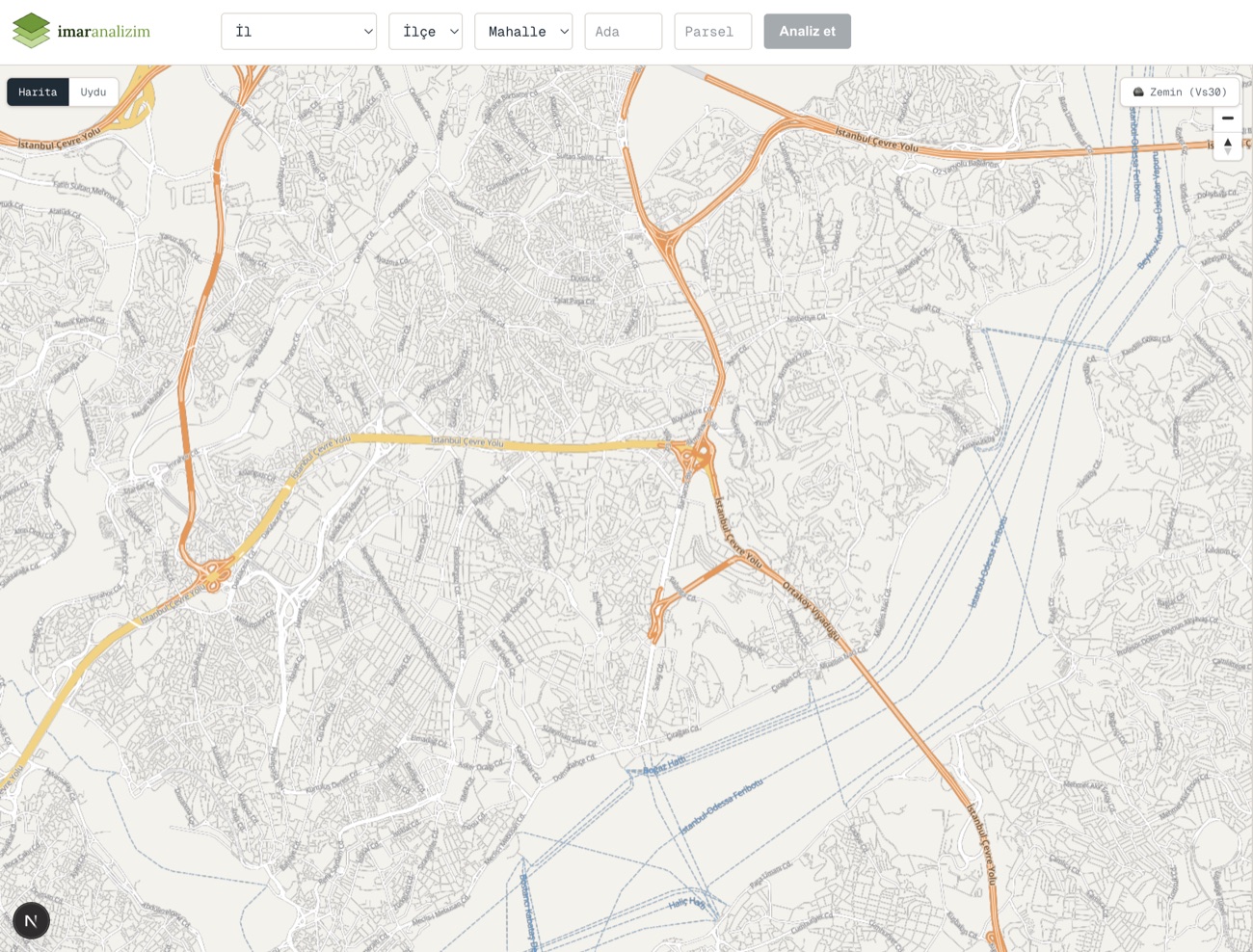
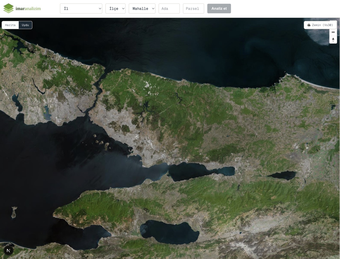
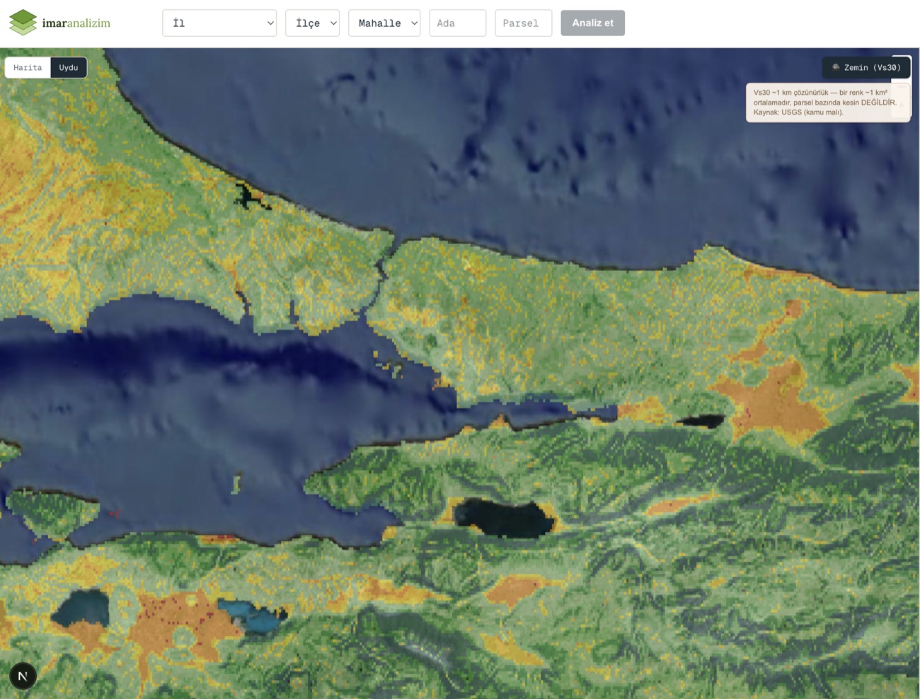
View the parcel on a plain map base, on a current satellite image, or on the regional ground (Vs30) layer; switch between the three with a single click. The parcel boundary is drawn clearly on every layer, so you can compare roads, surrounding development and the regional ground indicator on the same screen.
Development opportunities
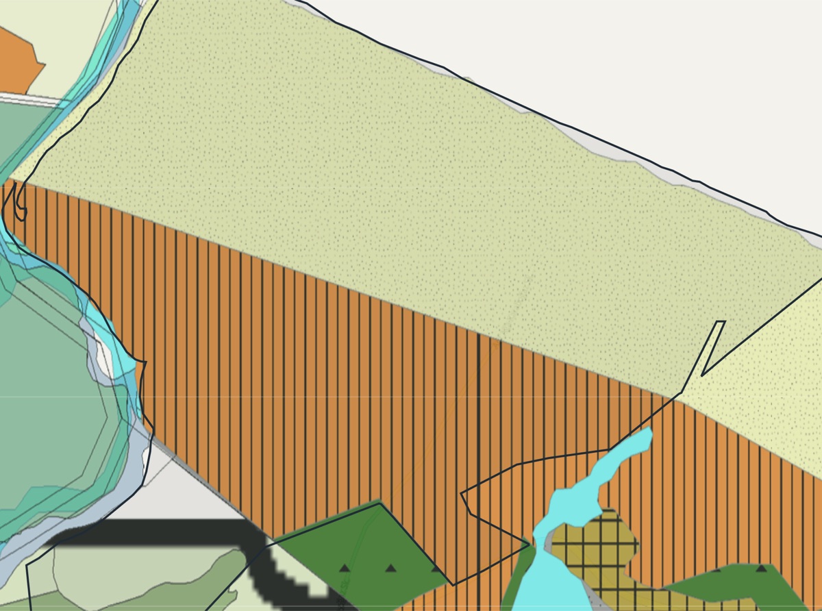
We compare the title-deed property type against the plan function and highlight situations that may create added value — such as “farmland on the title deed, residential area on the plan — or a tourism area”.
Live cadastre and coordinates
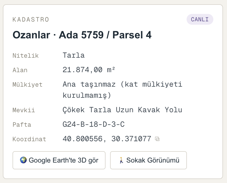
Enter the block and parcel number and see, within seconds, the property type, area, ownership status (whether condominium ownership has been established, or whether it is a main property), locality and map sheet — pulled live from the official cadastre. The parcel's coordinates are copied to the clipboard with one click. With the Google Earth 3D and Street View links you can inspect the land from your desk, as it actually is.
Zoning status and buildable capacity
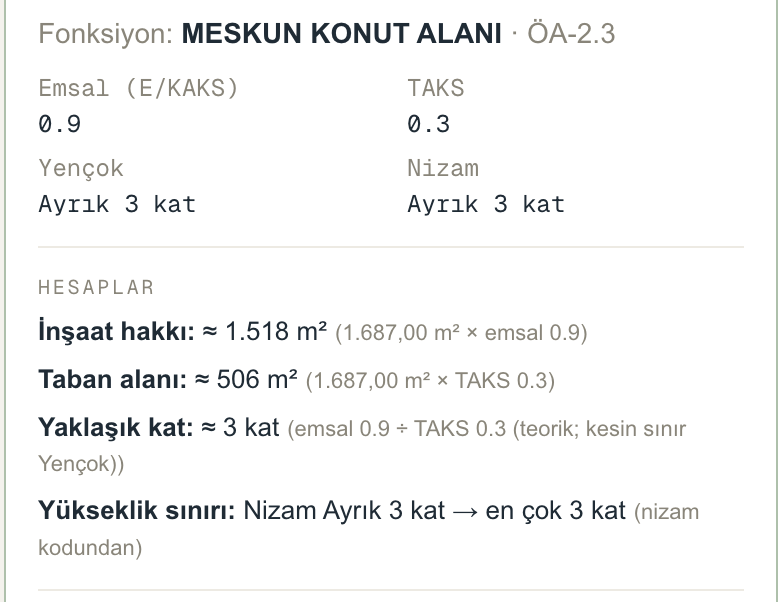
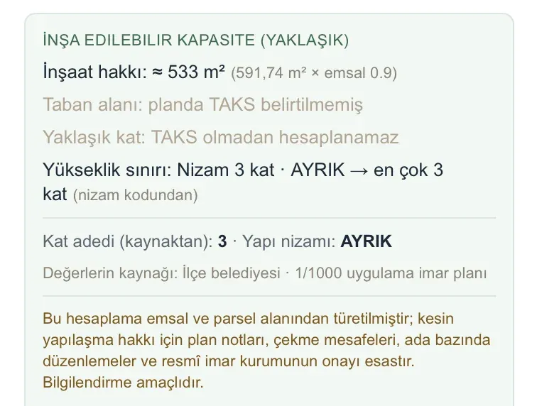
Floor Area Ratio (Emsal / E, KAKS), Building Coverage Ratio (TAKS), maximum height (Yençok) and building layout are read from the official plan; directly below comes the buildable capacity derived from those values: buildable floor area, building footprint and height limit. The inputs of the calculation are shown too — you see where each number comes from. If a value is not stated in the plan it is not invented; it says “TAKS not specified” and that line is not calculated.
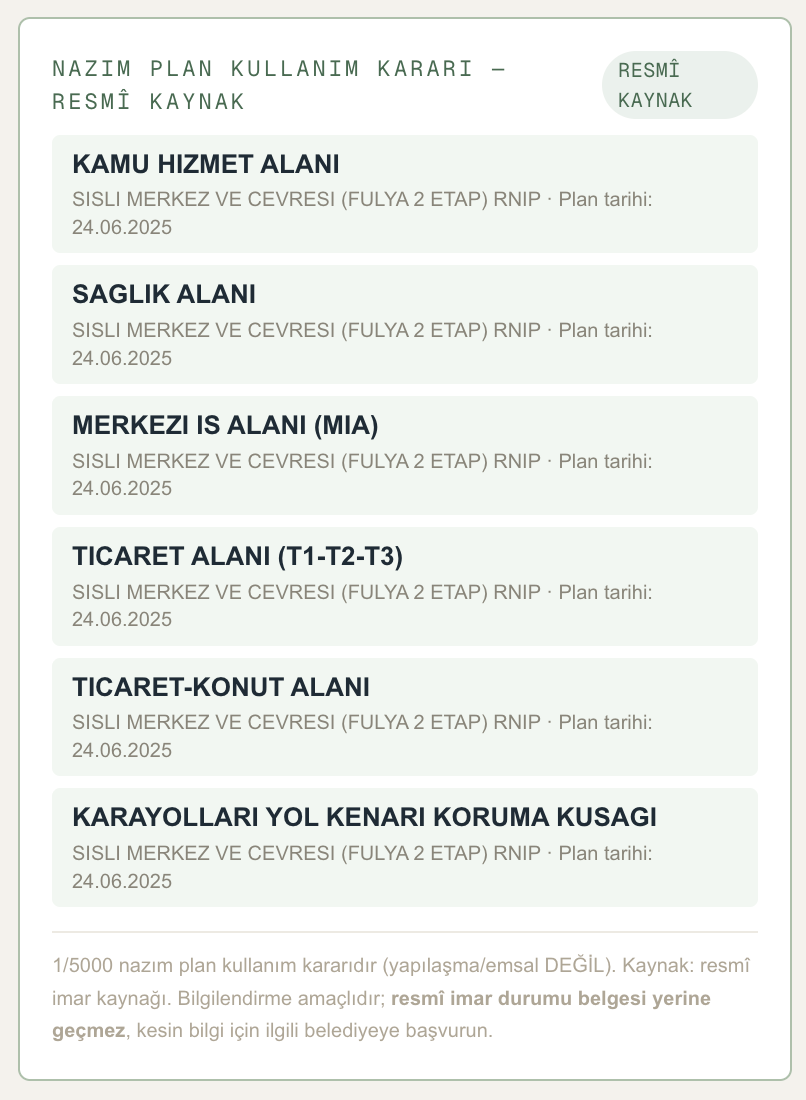
Plan land-use decisions
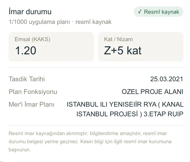
We show the parcel's land-use decision at two plan levels separately. First comes the decision of the plan IN FORCE (mer'i) at 1/1000: in the first image the parcel's plan function reads “Özel Proje Alanı” and the plan in force it belongs to reads “İstanbul İli Yenişehir RYA (Kanal İstanbul Projesi) 3. Etap RUİP”, together with its Floor Area Ratio (Emsal) and approval date — so you can see on screen which major project's plan decision the parcel falls within. At the second level, 1/5000 master plan decisions are listed: regional uses such as public service, health, commerce and central business area, with the plan name and date. This feature is not available in every province; it is for information only and is not a substitute for an official zoning certificate.
Helpers that work on top of the map
Measure, compare, mark and export without leaving the analysis screen.
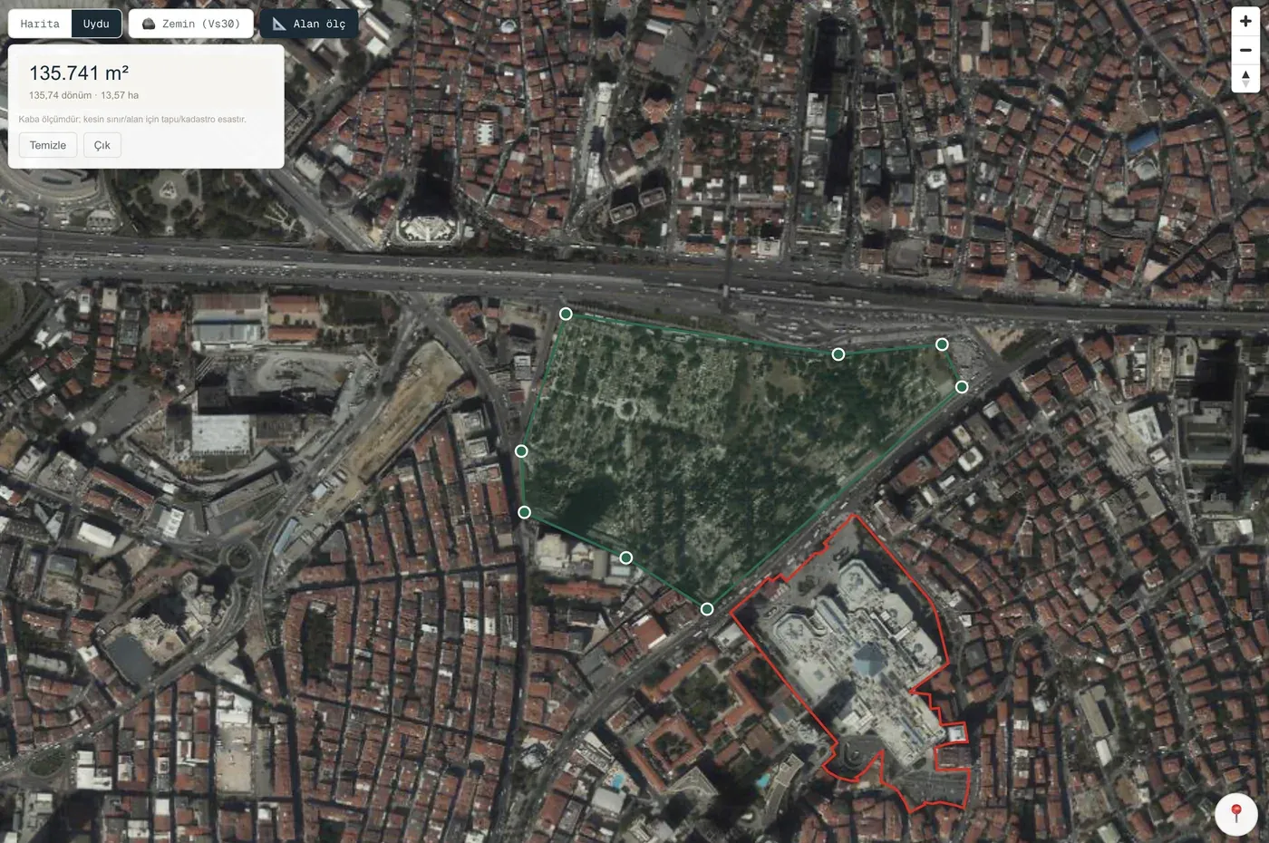
Area measurement
Mark the corners on the map and we calculate the enclosed area instantly in m², dönüm and hectares. It is an approximate measurement — the title deed and cadastre are authoritative for the exact boundary.
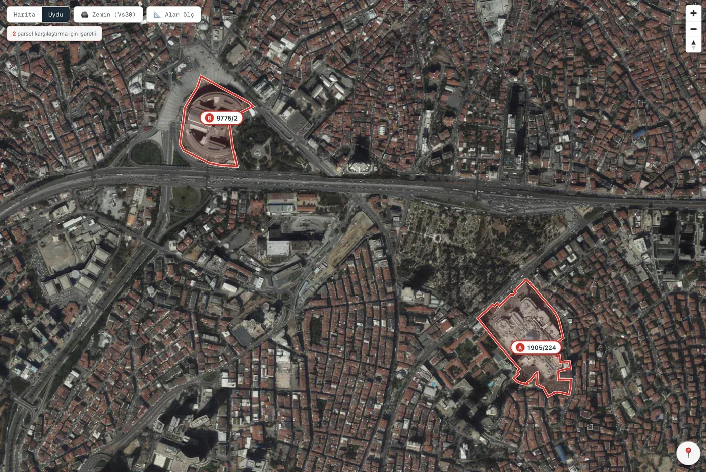
Parcel comparison
Mark up to four parcels at once and compare them side by side. Marked parcels appear on the map with A/B/C/D labels. We do not score them or tell you to “buy this one”; we place the data side by side and you decide.
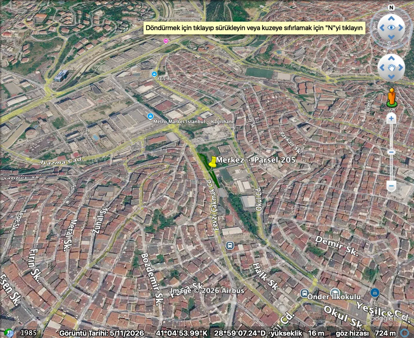

KML download
Download the parcel boundary as a .kml file with one click; open it in Google Earth and inspect the land in 3D with its real surroundings. The file is generated entirely in your browser.

Live location
Mark your position on the map while you are on site and see, on the spot, which parcel you are standing on.

Favourite parcels
Add the parcels you are interested in to your favourites; your list stays in your profile and you return to the analysis with one click.
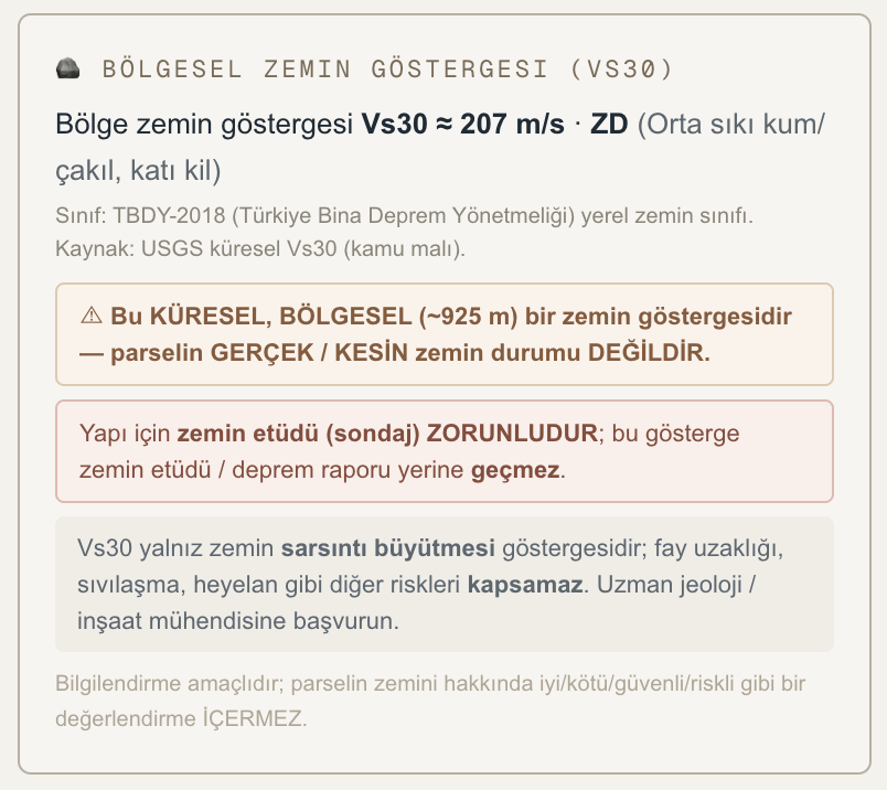
Regional ground indicator
We present the Vs30 value, which indicates the ground's tendency to amplify shaking, together with the local ground class under TBDY-2018. This is a global and regional (~925 m) indicator; it is not the parcel's actual, definitive ground condition and is not a substitute for a geotechnical survey.
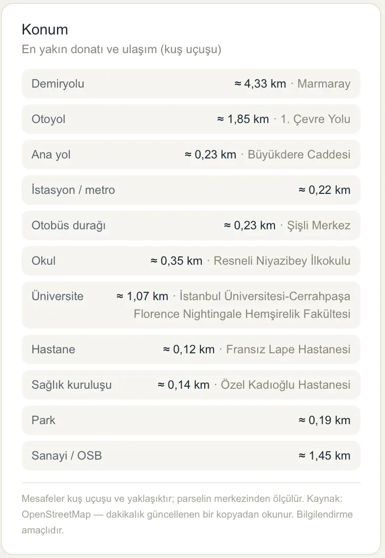
Location analysis — 11 categories
The nearest school, university, hospital, health facility, park, metro/station, bus stop, main road, motorway, railway and industrial zone/OIZ — see the straight-line distance to eleven categories on a single card, together with the name of the facility. Weigh the effect of location on accessibility and investment value within seconds. Distances are measured from the centre of the parcel, calculated from up-to-date map data, and are approximate.
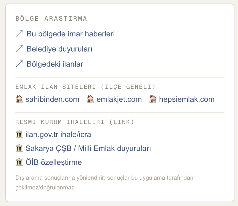
Research the area from one panel
Brings together ready-made search links for local zoning news, municipal announcements, property listings and official sale/tender notices in one panel. Property links are PRE-FILLED by the parcel's neighbourhood, property type and area; official notice links by province and district — you do not have to build the search from scratch. Listing data is not stored in this application; the links take you to the relevant source and the results are live at that source.
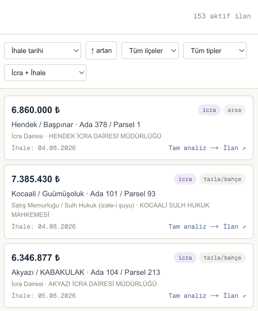
Ready-made search for enforcement and public sale notices
Property sale notices from enforcement offices, sales officers, municipalities and Milli Emlak are published on the official notice portal. Open the search link prepared for the province and district of the parcel you queried with a single click — the notices come to you at the source, always in their current form. Listing data is not stored or copied in this application. The reserve price is the auction's starting price; it is not a market value or investment advice.
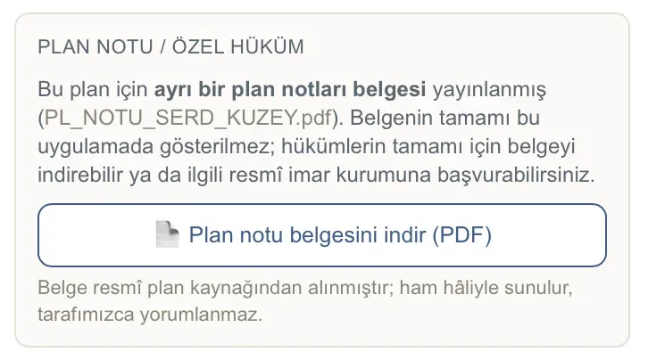
Plan notes and special provisions
Floor Area Ratio (Emsal) and floor count alone are not enough: what may be built on a parcel is often determined by the plan notes. These notes are not central — they are prepared by the MUNICIPALITY that approves the plan for each area and introduce provisions specific to that plan. If a separate plan-notes document has been published, we show it on the card and let you download it; the document is presented exactly as it comes from the official plan source, and is not interpreted or summarised by us.
- Not available in every province or parcel — This service cannot be provided in ALL covered provinces: some plans have no separate plan-notes document. In that case the card does not appear at all — a document that does not exist is never shown as if it did.
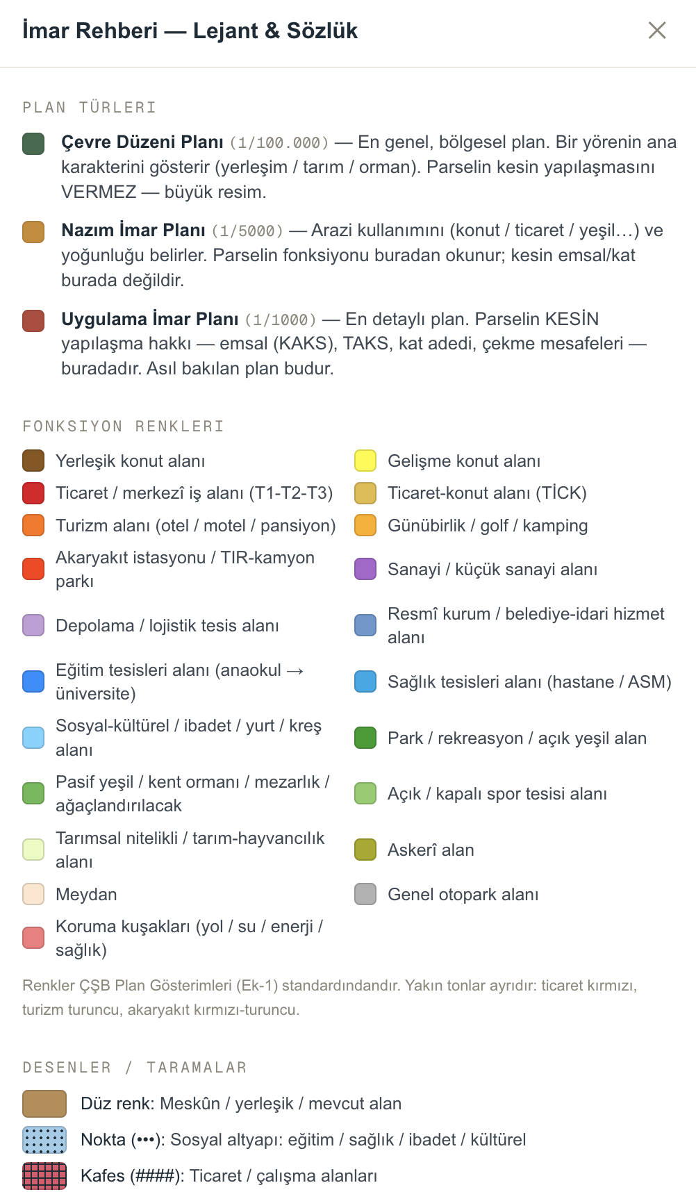
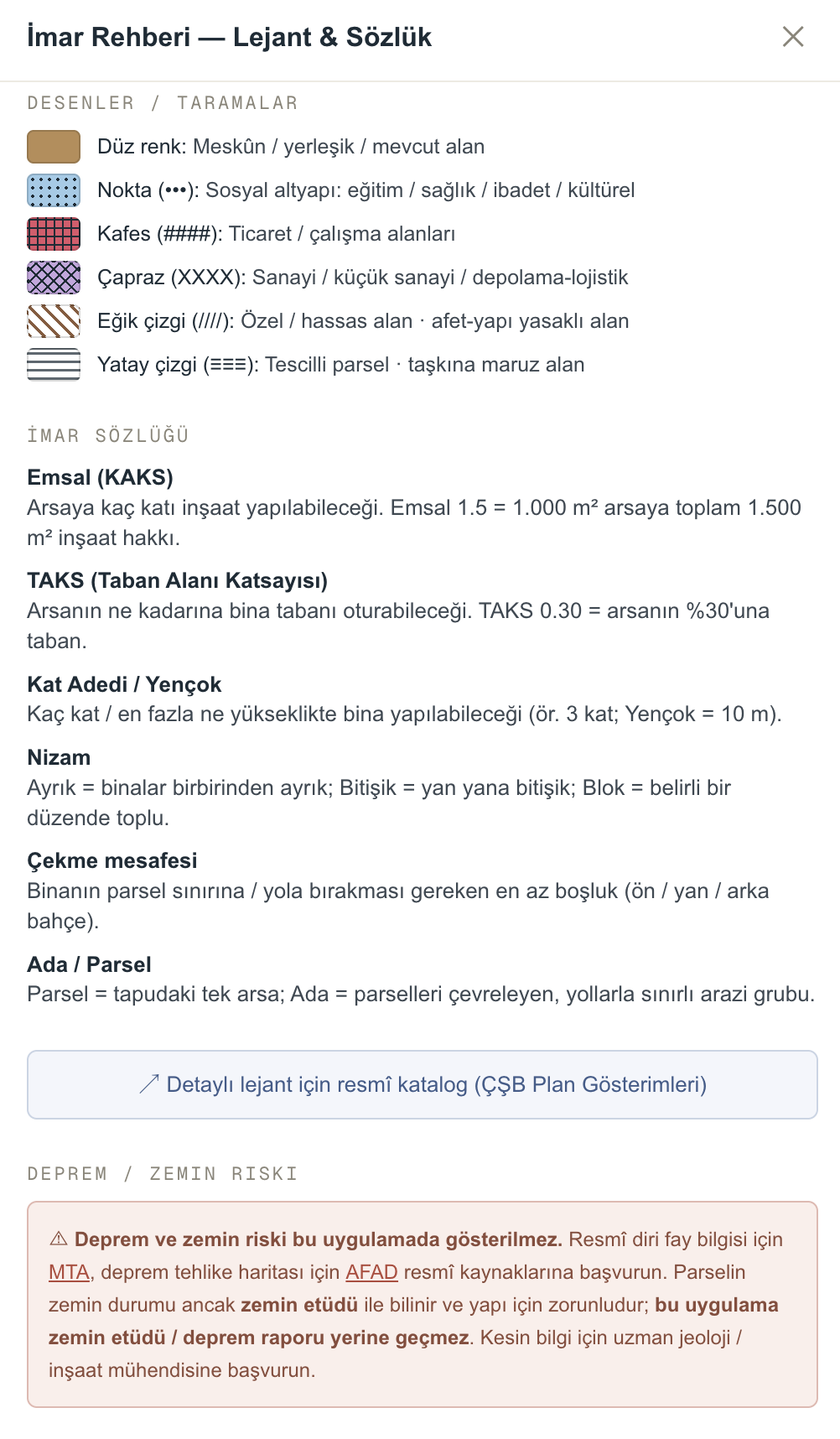
Zoning guide, glossary and legend
We explain which function each plan colour and pattern corresponds to, and what concepts such as Floor Area Ratio (Emsal), Building Coverage Ratio (TAKS), maximum height (Yençok), building layout and setback mean — with the regulatory legend and a glossary. It was written so that even someone entirely new to the subject can read a plan. Whenever a term stops you, the answer is always at hand.
Two kinds of report
A quick summary, or a detailed data document for an expert's file — both with one click.
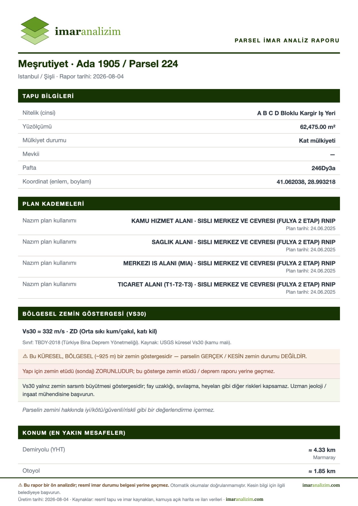
Basic Report — a quick summary
Reduces the parcel's identity, zoning status and surrounding information to a tidy one-page summary. For sending to a client quickly, explaining the situation to your partner, or screening out a plot: no unnecessary detail, just the headings a decision needs. Created with a single click.
- Parcel identity · zoning status · buildable floor area calculation
- Plan levels · regional ground indicator · location distances
- Map view with the parcel boundary marked
 Click to enlarge
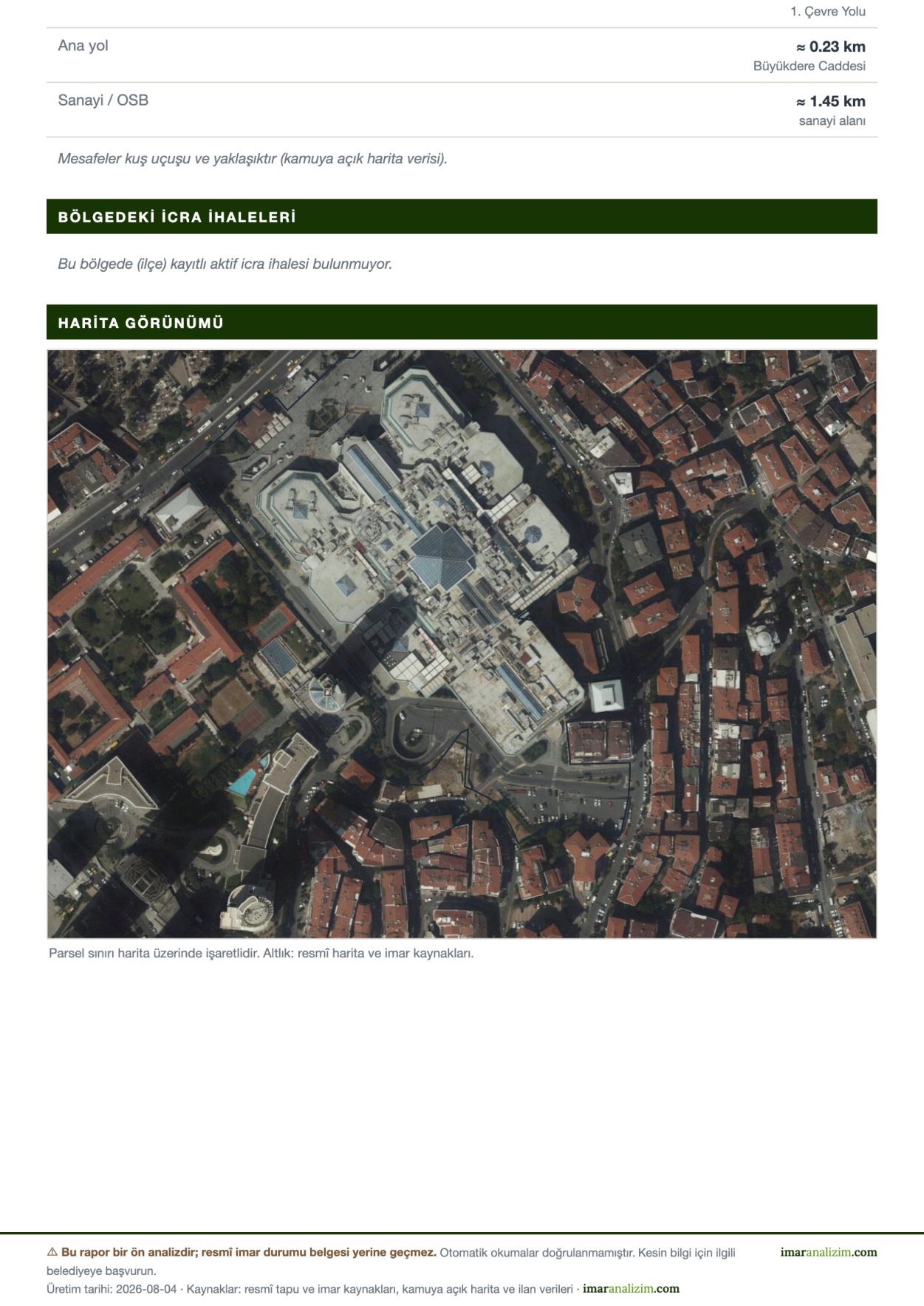 Click to enlarge
Valuation Data Pre-Report (Değerlemeye Esas Veri Ön-Raporu)
A detailed nine-section document prepared to go into a licensed valuation expert's file. It forms an INPUT to the expert's own examination: it gathers data compiled from official and institutional sources into a single document, with its reference details, date and source list. The document IS NOT A VALUATION REPORT and contains no valuation — it states this plainly on the cover page as well. You can click on the pages to examine the whole document on screen.
- 1. Cover · 2. Report reference details · 3. Property identity (title deed/cadastre)
- 4. Zoning status and buildable capacity · 5. Location and surroundings · 6. Ground and disaster
- 7. Market and comparable research · 8. Matters for the expert to complete · 9. Sources and legal notes
Every report carries a signed report number. The number is written in the report's reference details and footer; the party receiving the report can confirm from the report verification page that the document was produced by us.
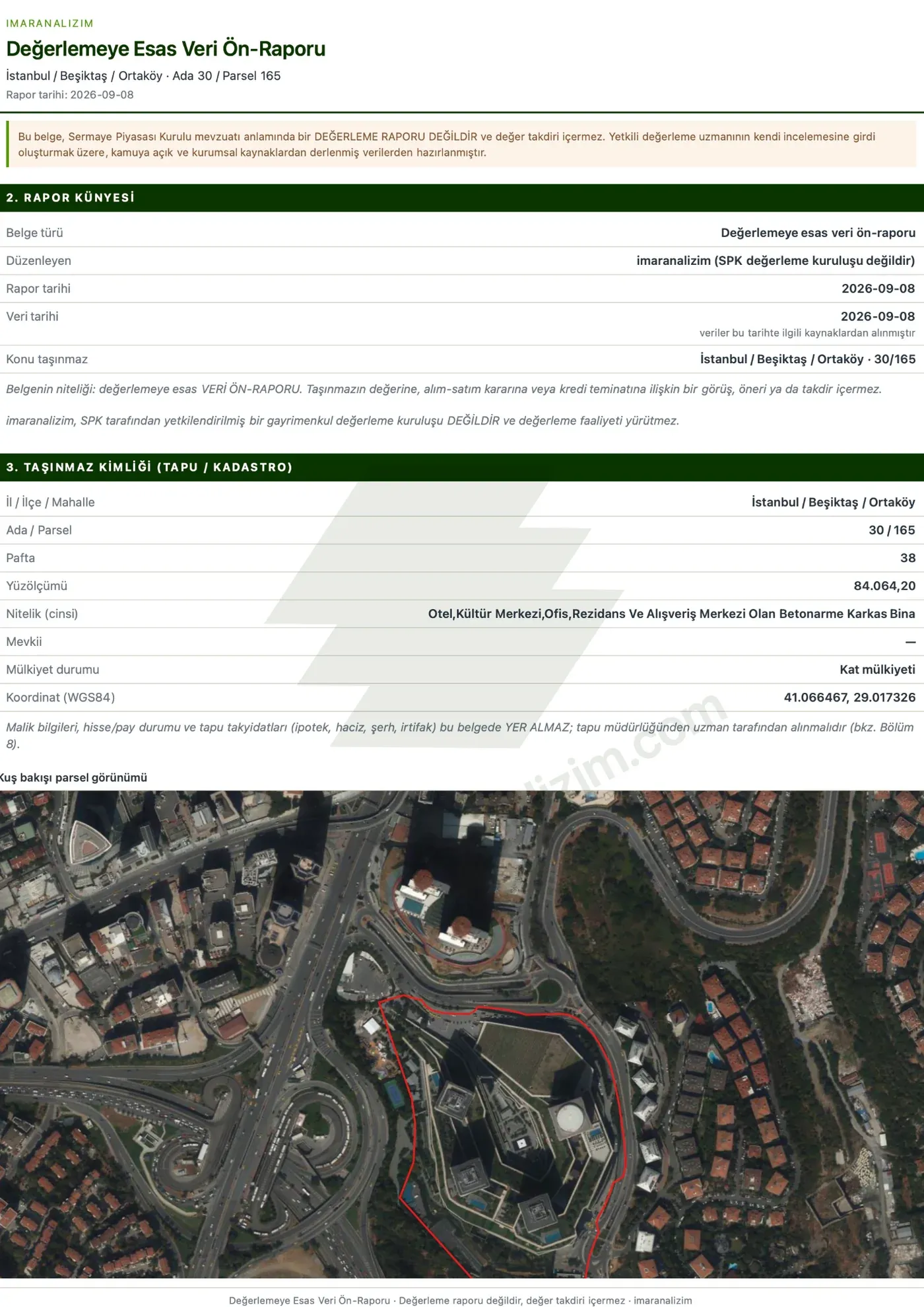 Click to enlarge
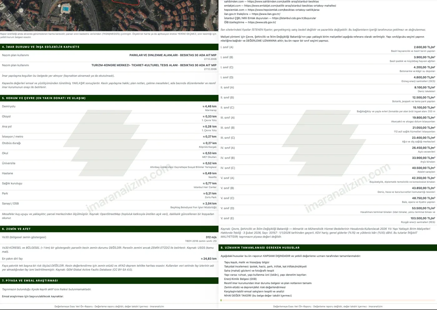 Click to enlarge
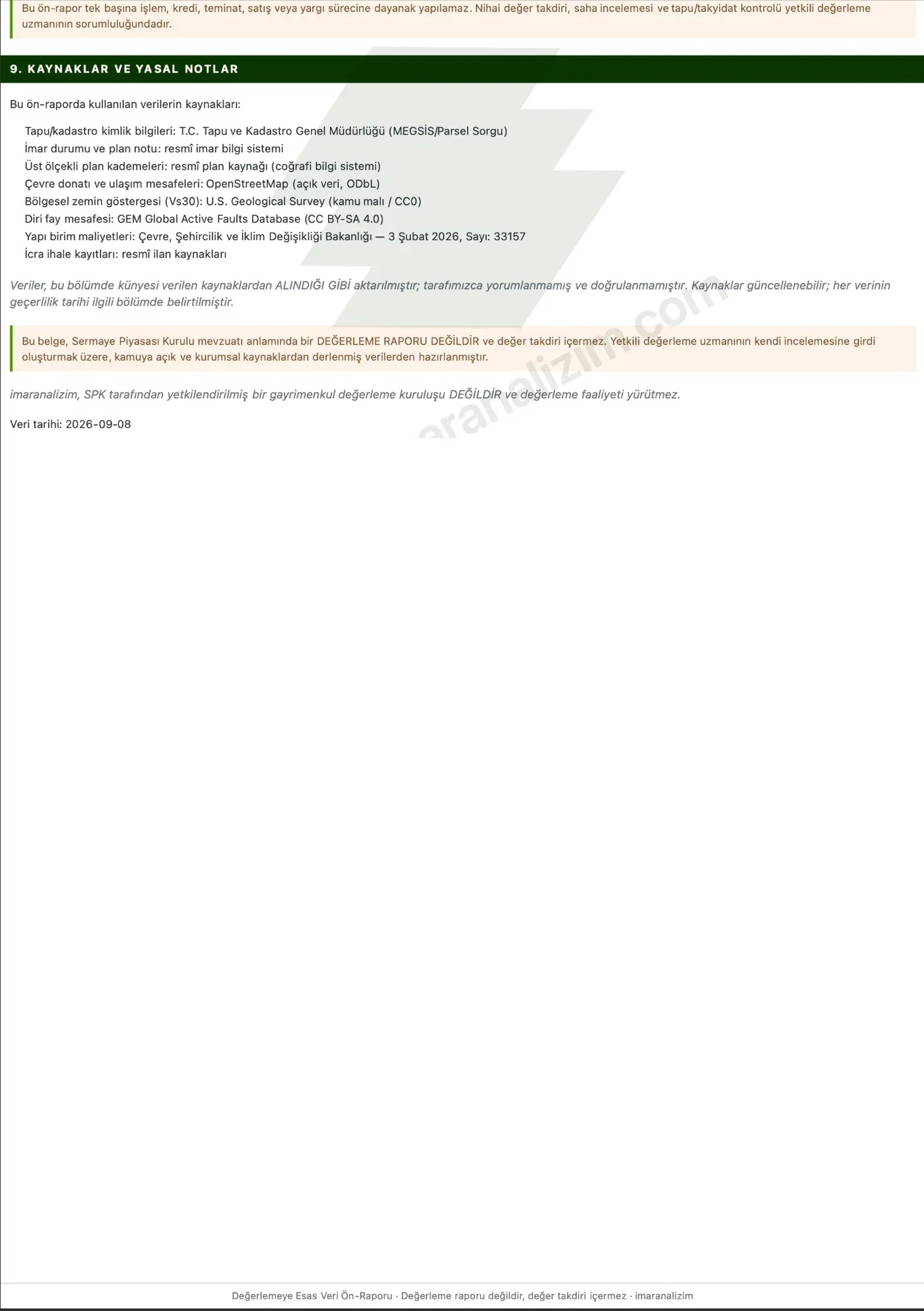 Click to enlarge
We do not make things up. If there is no data we say “could not be read”; we never show a guess.
Our reports are a preliminary analysis; they are not a substitute for an official zoning certificate.
Who is it for?
Individual landowners
Find out what the land you hold actually is without going to the municipality: its zoning status, how much buildable floor area it has, which function it is allocated to in the plan — in plain language, on one screen.
Estate agents
Explain the potential of a plot in your portfolio to the client with clear figures.
Property consultants
In a portfolio meeting and out on site, answer “what can be built here?” from your phone: zoning status, buildable floor area and plan function at your fingertips. Meet the owner with data, using a presentation-ready report.
Individual investors
Weigh the development rights, the ground and the location on one screen before you buy; verify for yourself what the agent told you.
Contractors
See a parcel's buildable floor area, building footprint and height limit at first glance.
Licensed valuation experts
While preparing an appraisal report, reach the parcel's zoning status, Floor Area Ratio (Emsal), ground and location data from one screen; add the PDF output straight to your file.
Explain the parcel to your client
A full-screen presentation that starts with the parcel's identity, orbits its surroundings and shows the plan levels in sequence. Controlled with the keyboard: space pauses, arrow keys change step.
Perspektif görünüm · yükseklik verisi içermez. The presentation is a preliminary analysis; it is not a substitute for an official zoning certificate.
Available on Bireysel Pro and above.
Paketler
A parcel counts once: reopening the same parcel does not reduce your quota.
Bireysel
For the property consultant, investor or landowner working on their own.
- Single user
- 50–200 queries per month
- Valuation Data Pre-Report (Değerlemeye Esas Veri Ön-Raporu): only Bireysel Max
- Your own logo on reports: only Bireysel Pro, Bireysel Max
- Virtual drone presentation: only Bireysel Pro, Bireysel Max
Kurumsal
For real-estate offices and valuation firms with more than one employee.
- 5–10 users
- Shared pool of 500–1.000 queries
- Invitations by e-mail and an office panel
- A parcel opened by one person in the office does not use anyone else's quota
- Valuation Data Pre-Report (Değerlemeye Esas Veri Ön-Raporu), logo and presentation: on all plans
Frequently asked questions
What is imaranalizim for?
Instead of spending time at public offices and searching for plans across different systems, you enter a block/parcel number and see that parcel's plan levels, building rules, ground information and surroundings on a single screen.
What does it make easier?
It lets you do a preliminary land assessment in minutes: a quick check before presenting to a client, screening before an investment, gathering data for a valuation file. With presentation mode and the PDF report you can show your findings to the client directly.
What are plan levels?
Implementation Development Plan 1/1000 (Uygulama İmar Planı): determines what may be built on the parcel — Floor Area Ratio (Emsal), Building Coverage Ratio (TAKS), building height, setbacks and building layout.
Master Development Plan 1/5000 (Nazım İmar Planı): determines the land use and density of the area — housing, commerce, green space, industry.
Environmental Plan 1/25,000 and 1/100,000 (Çevre Düzeni Planı): upper-scale regional plan — development areas, agricultural areas, protected zones.
Read together, the three show both a parcel's present state and the direction its surroundings are taking.
Is the data current?
Plan and parcel information is pulled from official sources at the moment you query. If a source cannot be reached at that moment we say so plainly — we do not say “there is no plan”. Enforcement and tender notices we do not copy or store: for those we send you straight to a prepared search on the official notice portal, so what you see depends on the source itself rather than on how often we update.
Can the information be wrong?
What we show is what the official source returns at that moment; an error or delay at the source can carry through to us. Plan amendments still on public display may not yet be recorded at the source. Information read by artificial intelligence is marked separately and must be verified. imaranalizim is a preliminary review tool; it is not a substitute for an official zoning certificate — confirm with the relevant municipality before any binding transaction.
What should I do if I find an error?
Send the province, district and block/parcel number — and a screenshot if possible — to imaranalizimdestek@gmail.com. We review every report.
Which provinces does it cover?
Plan data is available in these provinces: Sakarya, İstanbul, Kocaeli, Ankara, İzmir, Antalya; partially in Bursa. Coverage is expanding. Parcel and title information can be viewed for the whole of Türkiye.
Do you perform valuations?
No. imaranalizim does not determine a parcel's value; it provides the data a valuation is based on. Valuation is the authority of a licensed valuation expert.
How does the free trial work?
Once you register, the 3-day period starts the moment you begin the trial; you can query 3 parcels per day. Reports and presentation mode are disabled during the trial.
Does reopening the same parcel use up a query?
No. A parcel counts once; reopening the same parcel does not reduce your remaining queries. On the corporate plan, if someone in your office has already queried it, the others open it without spending a query.
Who is the corporate plan for?
For real-estate offices and valuation firms with more than one employee: a shared query pool, invitations by e-mail, an office panel and your own logo on reports.
How is delivery handled?
There is no physical delivery. Your package is activated in your account the moment the payment is approved and can be used immediately.
Analyse your land now
Enter the block and parcel number and have a preliminary analysis in seconds.
Create account